| April 26, 2024 | ||
| Search |
| Current Training |
By Course Title |
| Course Catalog |
| By Course Title By Training Partner By Delivery Method |
| Students |
View Registrations/Transcripts |
| About Trainex |
| Overview Contact Us Help! |
| OLEM Training Coordination Team |
| Locate
Team Members Regional/State Training Brochure |
| Other Training Resources |
| EPA Other U.S. Government |
To register for this event, click the Register Now button at the bottom of this page
| General Information | |
| Event Name: | Michigan Mapping Project Workshop |
| Hosted By: | U.S. EPA - Region 5
Emergency Response Team |
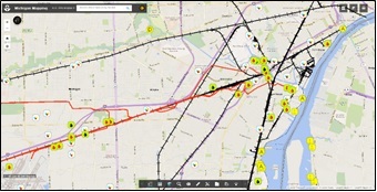
| Event Description: | The Michigan Mapping Project Geographical Information System (GIS) program is an environmental emergency response tool that brings public (federal, state and local) and private sector emergency responders together, working in one GIS format for spill response and pre-planning. During an emergency response, federal and state On-Scene Coordinators (OSCs) use the project to gain situational awareness of downstream/downwind vulnerabilities, as well as upstream/upwind potential responsible parties. For contingency planning, the project can introduce facilities to the communities which may be impacted during a hazardous materials and/or petroleum release. The program can also be used during exercises of facility response plans by providing participants access to response layers such as: endangered/protected species and habitats; sanitary and storm sewer systems; facility discharge and permit discharge points; water supplies; other pollution sources (facilities, oil wells, pipelines, rail lines, etc.); and vulnerable populations (schools, nursing homes, daycare facilities, hospitals, etc.). The Michigan Mapping Program can be accessed at the following website: www.rrt5.org, (select the Interactive Mapping Tab-Stakeholder Version).
PURPOSE The 4-hour workshop is designed to provide an overview of the Michigan Mapping Program. Michigan stakeholders will be provided with important information so that they can utilize and support this critical program. POINTS OF CONTACT
Tricia Edwards, On Scene Coordinator, 734-692-7687, edwards.tricia@epa.gov Address for all: U.S. EPA, 9311 Groh Road, Grosse Ile, MI 48138 |
| Additional Information: | AGENDA
8:30 AM to 9:00 AM - Registration |
| Registration Status: | Registration Open |
| Event Begins: | April 3, 2019 at 9:00 AM |
| Event Ends: | April 3, 2019 at 2:30 PM |
| Location | |
| This event will be held at: | Western Michigan University 1903 W. Michigan Ave. Geological and Environmental Sciences Computer Lab, Wood Hall 1207 Kalamazoo, MI 49008
**Participants will need to purchase a 1-day visitor pass from parking services, located at 2507 W. Michigan Avenue (one block east of the intersection of Howard Street and West Michigan Avenue): https://wmich.edu/parking. Parking services should be able to guide the participants with respect to nearby lots to Wood Hall. |
| Location Map: These maps are for getting a general idea of the location - they may not be 100% accurate. |
Click here to view 
|
|
||