| April 19, 2024 | ||
| Search |
| Current Training |
By Course Title |
| Course Catalog |
| By Course Title By Training Partner By Delivery Method |
| Students |
View Registrations/Transcripts |
| About Trainex |
| Overview Contact Us Help! |
| OLEM Training Coordination Team |
| Locate
Team Members Regional/State Training Brochure |
| Other Training Resources |
| EPA Other U.S. Government |
| Hosted by U.S. EPA - Region 5
Emergency Response Team |
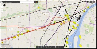
The Michigan Mapping Project Geographical Information System (GIS) program is an environmental emergency response tool that brings public (federal, state and local) and private sector emergency responders together, working in one GIS format for spill response and pre-planning. During an emergency response, federal and state On-Scene Coordinators (OSCs) use the project to gain situational awareness of downstream/downwind vulnerabilities, as well as upstream/upwind potential responsible parties. For contingency planning, the project can introduce facilities to the communities which may be impacted during a hazardous materials and/or petroleum release. The program can also be used during exercises of facility response plans by providing participants access to response layers such as: endangered/protected species and habitats; sanitary and storm sewer systems; facility discharge and permit discharge points; water supplies; other pollution sources (facilities, oil wells, pipelines, rail lines, etc.); and vulnerable populations (schools, nursing homes, daycare facilities, hospitals, etc.). The Michigan Mapping Program can be accessed at the following website: www.rrt5.org, (select the Interactive Mapping Tab-Stakeholder Version).
PURPOSE
The 4-hour workshop is designed to provide an overview of the Michigan Mapping Program. Michigan stakeholders will be provided with important information so that they can utilize and support this critical program.
POINTS OF CONTACT
Tricia Edwards, On Scene Coordinator, 734-692-7687, edwards.tricia@epa.gov
Jon Gulch, On Scene Coordinator, 734 -692-7686, gulch.jon@epa.gov
Jeff Kimble, On Scene Coordinator, 734-692-7688, kimble.jeffrey@epa.gov
Address for all: U.S. EPA, 9311 Groh Road, Grosse Ile, MI 48138
| Upcoming Events No upcoming events. |
|
|